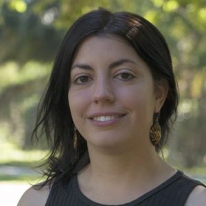
Morandeira, Natalia

Associate Researcher CONICET
Associate Professor 3iA -UNSAM.
https://nmorandeira.netlify.app/
https://www.researchgate.net/profile/Natalia-Morandeira
https://orcid.org/0000-0003-3674-2981
https://ar.linkedin.com/in/natalia-morandeira-97083044
https://www.scopus.com/authid/detail.uri?authorId=55955699300
Professional resume + Expertise
Natalia Morandeira is a Doctor in Biological Sciences from the University of Buenos Aires (UBA), Argentina. She is currently an Adjunct Researcher at the National Scientific and Technical Research Council (CONICET) and works at the Institute of Research and Environmental Engineering of the National University of San Martín (IIIA-UNSAM-CONICET). She is also an Adjunct Professor at 3iA-UNSAM, currently teaching Ecology. Between 2007 and 2020, she taught Landscape Ecology at the Faculty of Sciences and Natural Sciences of the UBA. She is a certified The Carpentries instructor and participates in Latin American communities of users of the R language. In addition to her academic profile, she is a fiction writer.
Her research area involves landscape ecology and community ecology, particularly in relation to the dynamics of floodplain wetland vegetation. She uses quantitative remote sensing (satellite image analysis) and Geographic Information Systems (GIS) for these topics. Most of her research activity is related to the Lower Paraná River floodplain and the analysis of active microwave (SAR) and optical satellite data. In marshes of the Paraná River Delta, she studied the functional and taxonomic diversity of the herbaceous vegetation communities. She contributed to the National Inventory of Wetlands in the Paraná Delta River Ramsar site, and has also participated in remote sensing researches conducted in other Argentinean wetlands. In the urban area of General San Martín, she was part of a working group that carried out an environmental geographic diagnosis and a sanitary risk assessment, including GIS and geostatistics applications. She is currently leading the project "Development of an integrated wetland monitoring and management system based on satellite information", funded by the Argentina National Space Activities Commission through the PROSAT II program, which aims to develop applications with SAR and optical satellite data including the Argentinean SAOCOM Mission.
Keywords:
ecology; GIS; landscapes; remote sensing; wetlands
Research:
- Floodplain wetlands dynamics
- SAR and optical remote sensing
- Landscape ecology
Important publications:
- Morandeira, NS; M Barber, F Grings, F Ahern, P Kandus, B Brisco. 2021. Response of Multi-Incidence Angle Polarimetric RADARSAT-2 Data to Herbaceous Vegetation Features in the Lower Paraná River Floodplain, Argentina. Remote Sensing 13(13), 2518.
- Kandus, P; P Minotti, N Morandeira, M Gayol. 2019. Inventario de Humedales de la Región del Complejo Fluvio-litoral del Bajo Paraná. Programa Corredor Azul. Fundación Humedales / Wetlands International y Universidad Nacional de San Martín. 200 pp. Buenos Aires, Argentina.
- Morandeira, NS; PS Castesana, MV Cardo, VN Salomone, MV Vadell, A Rubio. 2019. An inter-disciplinary approach to assess human health risk in an urban environment: a case study in temperate Argentina. Heliyon 5 (10), e02555: 1-13. doi: 10.1016/j.heliyon.2019.e02555
- Morandeira, NS; P Kandus. 2017. Do taxonomic, phylogenetic and functional plant α- and β-diversity reflect environmental patterns in the Lower Paraná River floodplain? Plant Ecology & Diversity. doi: 10.1080/17550874.2017.1315838
- Morandeira, NS; P Kandus. 2016. Plant functional types and trait values in the Paraná River floodplain: modelling their association with environmental features. Flora 220: 63-73. doi:10.1016/j.flora.2016.02.007